Chesnut Land Surveying LLC provides accurate, reliable, and professional surveying services across Nashville and Middle Tennessee.
Professional experience you can trust
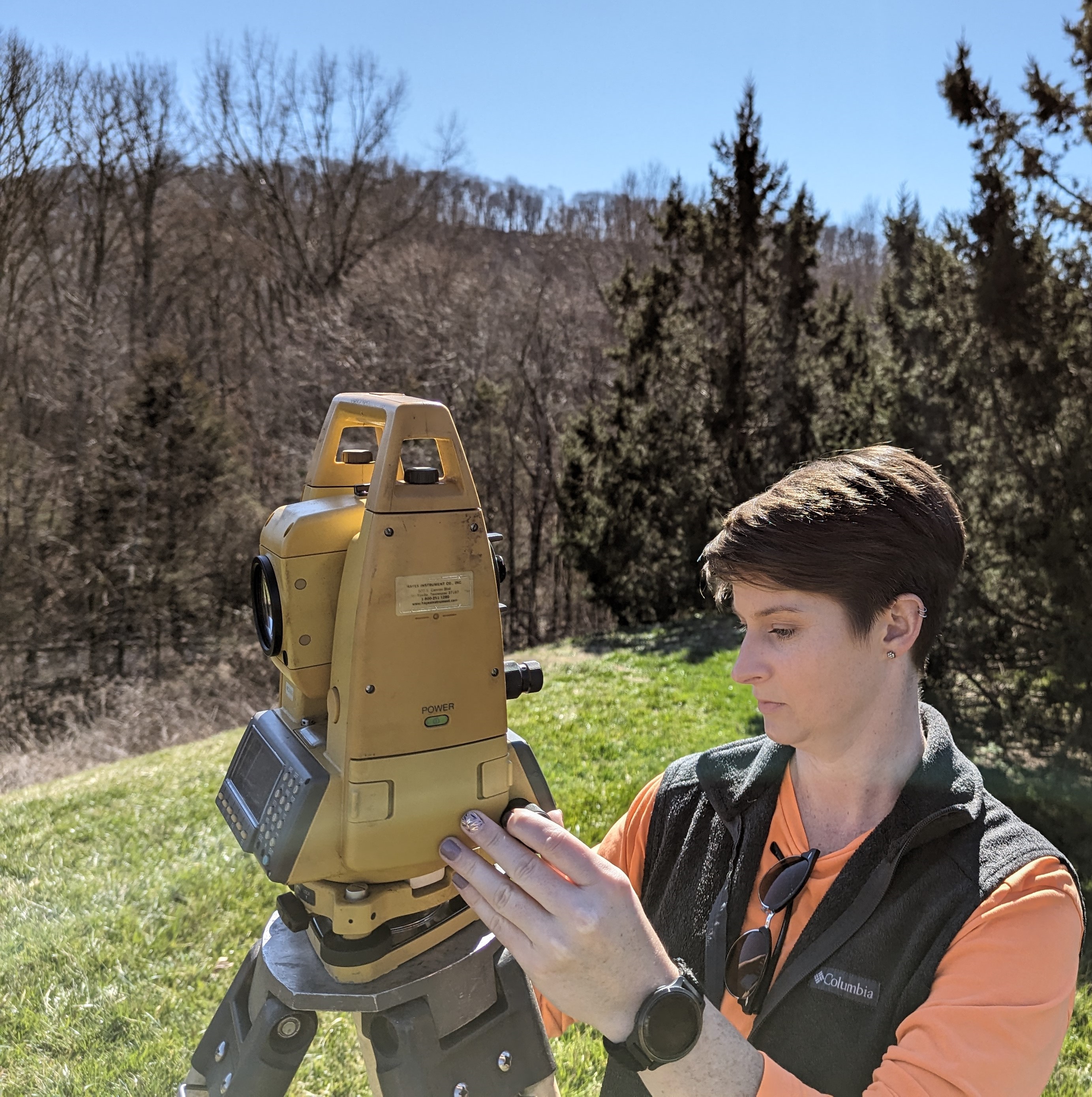
As a Registered Land Surveyor in Tennessee, I bring a high level of professionalism and attention to detail to every project. From in-depth research and precise fieldwork to creating comprehensive boundary maps, I am dedicated to delivering results that meet your specific needs and exceed your expectations.
My commitment to accuracy and client satisfaction drives my work, ensuring that each task is approached with care and expertise. I look forward to the opportunity to assist you with your surveying needs and contribute to the success of your project.
Serving Nashville and Middle Tennessee
Accurate boundary retracements for homeowners
As a solo-practitioner, I specialize in residential tracts of 10 acres or less. This focus allows me to provide the high level of personal attention and accuracy your property deserves. My comprehensive boundary retracements include thorough historical research, careful verification, and precise measurements using professional-grade equipment. Each survey includes a detailed map clearly defining your property lines.
Request QuoteAs an add-on to boundary surveys, I'll place temporary wooden stakes along your property lines to provide a clear visual reference of your boundaries. This is especially helpful for fence installation, construction projects, or resolving neighbor disputes.
Request QuoteI only offer this service for tracts less than 3 acres. My topographic surveys map the elevations and features of your land. I take field-measure elevations and use them to generate a contour map of the property. Only ground elevations are located (no trees, FFE, etc). Digital CAD file available at discretion of surveyor.
Request QuoteTo maintain a high level of accuracy and personal service, I do not offer the following:
I predominantly provide services in the following counties:
Answers to common questions about land surveying
The timeline varies depending on property size, terrain, and the complexity of the deed records. Generally, you can expect the field work to take 1-2 days, with an additional 1-2 weeks for research, calculations, and drafting the final survey map. Please check the contact section below for my current booking availability.
Survey costs are based on the time required for research, field work, and drafting. Factors like heavy vegetation, missing property corners, or vague deed descriptions can increase the time required. I offer free quotes tailored specifically to your property and project needs.
Think of a boundary survey like the foundation of a house; you can't accurately place a window until the foundation is set. In surveying, property lines relate to each other, and errors in one area can affect another.
To accurately certify even one line for you, I am professionally required to verify the entire boundary. This involves researching the full deed, locating corners on all sides, and cross-checking measurements to ensure the results are accurate and legally defensible. That is why pricing reflects a complete boundary survey rather than a single line.
A metal pin in the ground isn't a legal boundary on its own. Pins can be moved, bumped by lawnmowers, or even placed incorrectly by non-professionals years ago. A survey confirms if those pins are actually in the legal location described in your deed. A "found" pin with no current survey map has no legal weight in a dispute or for a permit.
As a licensed professional, I cannot legally "borrow" another surveyor's work or assume their markers are correct without verifying them myself. To protect your property rights, I must perform independent research and measurements to ensure the boundary is correctly established based on your specific deed of record.
Metro Nashville often requires a detailed survey for Contextual Site Plans, Residential Infill rules, or Stormwater Management. These requirements ensure you aren't violating "setbacks" or causing drainage issues for your neighbors.
Please note that for complex projects requiring formal grading or drainage design, you will likely need a firm that provides both Civil Engineering and Land Surveying. I specialize in residential boundaries and do not provide engineering or multi-layer site plans.
A boundary survey is the research, measurement, and creation of a certified map. Property line staking is an additional service where I place wooden stakes along the lines between corners to provide a clear visual reference. Staking is an add-on to a survey, not a standalone service.
Think of surveying as a giant puzzle. Your property corners are shared with your neighbors, and to verify the accuracy of your lines, I often have to locate the "neighbor's pieces" (their corners). It is very common for shared property markers to be located inside a neighbor's privacy fence or behind their gate.
To ensure your survey is 100% accurate, I may need to briefly access these shared corners, so access through gates is essential. I highly recommend notifying your neighbors in advance that a surveyor will be working along the property lines. This prevents confusion and ensures I can access the evidence needed to protect your property rights.
A survey is an unbiased, professional opinion of your property lines based on the legal deed of record. While I cannot force a neighbor to accept the results, my certified map and the monuments I set provide you with the professional documentation needed to support your property rights.
If a neighbor disagrees with the results, their recourse is to hire their own licensed surveyor to perform an independent retracement. If two professional surveys differ, it becomes a legal matter that must be handled by your respective attorneys. As a surveyor, I am an expert reporter of the boundary based on the evidence; I do not have the authority to "enforce" the line or settle legal arguments between neighbors.
Please note: Professional survey monuments are the legal record of your boundary. Intentionally moving or disturbing them can lead to significant headaches and additional costs to have the corners reset later.
No. My role is to map the surface of the land and the soil suitability areas designated by a soil scientist. I do not locate or inspect underground septic tanks or pipes. If you need to find the location of an existing tank, I recommend contacting a licensed septic pumper or installer.
Not necessarily, but if the brush is very thick, it may slow the field work down. If you are planning a fence and want the lines clearly staked, clearing a path along the expected property line ensures the stakes are visible and easy for your installers to follow.
I locate visible evidence of utilities (meters, manholes, etc.), but underground lines are only shown on the map if they are marked by Tennessee 811 prior to my arrival. For public lines, visit Tennessee811. For private lines (irrigation, pool lines), you must hire a private locator.
As an additional service, I can provide a written "Metes and Bounds" description. This is a formal text used in deeds if your current description is outdated or vague. While I provide the technical text, you will still need to work with an attorney or title company to have it incorporated into a new recorded deed.
The standard deliverable is a certified PDF map sent via email. This is accepted by most lenders, fence companies, and codes departments.
If you intend to record the survey with the Register of Deeds, they often require a physical paper copy with a "wet-ink" signature, which I can provide for an additional printing and mailing fee.
Drafting takes time to ensure accuracy. You can typically expect your completed map within 2 weeks of the site visit. Your invoice will be sent via email along with the map and is due 15 days from the date of issue.
No. I specialize exclusively in existing residential boundary retracements. Subdividing land involves complex Planning Commission reviews and engineering requirements that are better handled by a larger, multi-disciplinary firm.
To provide an accurate quote, I need the property address, the approximate acreage, and the reason you need the survey. You can provide all of this information through the contact form below.
I am a solo practitioner and I handle every part of the business personally—from research and field work to drafting and invoicing. This ensures the highest level of accuracy for your property. If I haven't reached out yet, it is likely I am currently in the field or working through the queue of requests received before yours. I appreciate your patience and support of my small business!
Get in touch for a free quote
Currently not accepting new projects
Nashville and Middle Tennessee
Tuesday - Friday: 9:00 AM - 3:30 PM
Thank you for supporting my small business! As a one-person shop, I handle all requests on a first-come, first-served basis. To ensure the highest accuracy for every client, current lead times are:
Note: During periods of high volume, these timelines may extend. I appreciate your patience as I work to provide thorough and accurate records for your property.
Due to an overwhelming volume of requests and a schedule that is currently fully booked through 2026, I have made the decision to temporarily pause new quote requests.
